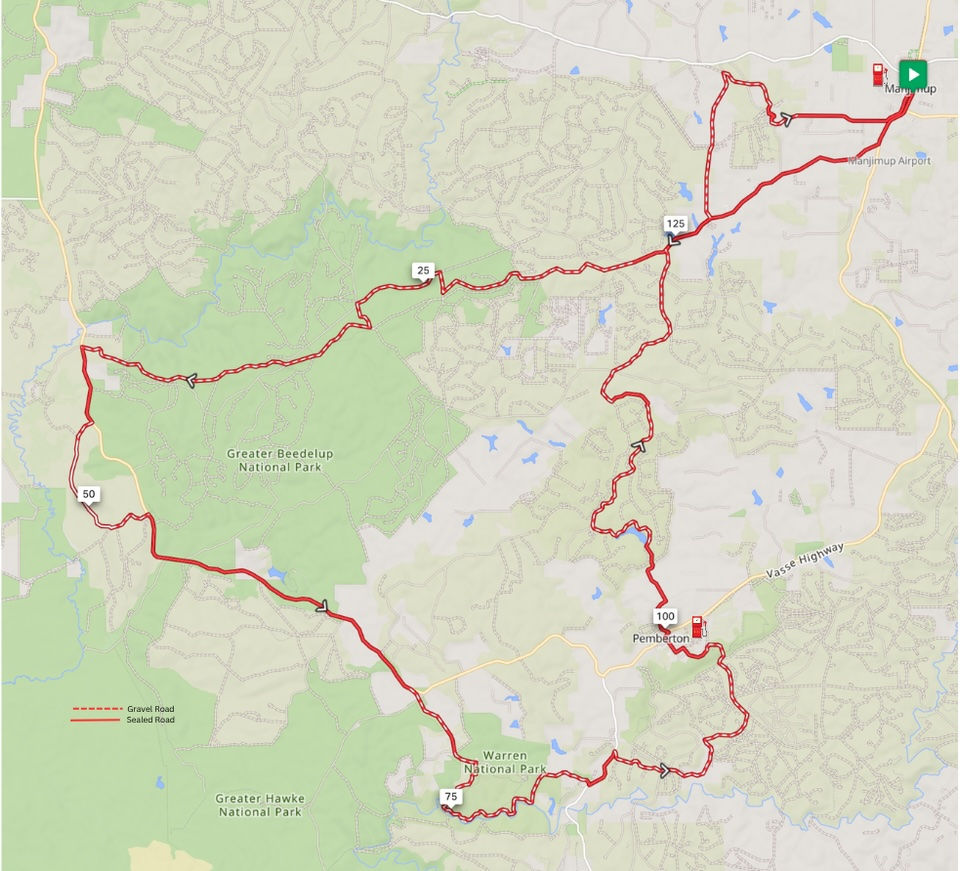
Pemby West is actually two routes - a dry season route which includes river crossings at Power Rd and Collins Rd, and a wet season route which avoids the river crossings.
IMPORTANT: The dry season route is only safe in Summer and Autumn, but may be unsafe at any time after heavy rains.
This route starts with a bitumen transport section down Seven Day Rd before hitting the gravel. It features a 3.5km single trail section pruned specifically for trail and adventure bikes before heading across Vasse Highway and south.
The wet season trail then takes in the picturesque Heartbreak Trail, while the dry season trail continues south to cross the Warren River at Powers Rd and again at Collins Rd. Both trails converge close to Pemberton where fuel, food and drink is available.
The route back to Manjimup is a flowy mix of gravel roads including the Rainbow Trail and Brook Rd before a northern excursion to the historic town of Deanmill.
This trail is fun on both enduro and adventure bikes. There is a little bit of sand on Jasper Rd, and the Powers Rd crossing is rocky - hence the Blue difficulty rating.
Pemby West
Classification More Difficult. Description More Difficult: Less maintained trails recommended for riders of intermediate skill level and above. Riders may encounter some rutted, narrow, loose, soft, rocky or slippery sections and hills with short steep sections and some smaller obstacles.
Distance Dry Season: 152km Wet Season: 144km Ride Time 3.5 hours Surface Dry Season: 74% unsealed. Wet Season: 71% unsealed Fuel Locations Pemberton Food Manjimup, Bridgetown, Donnelly River Points of Interest Warren River, Heartbreak Trail, Gloucester Tree, Pemberton, Big Brook Dam Watch out for River crossings when water is flowing. Power Rd crossing is rocky, Collins Rd crossing is very slippery. DO NOT ATTEMPT TO CROSS EITHER OF THESE WHEN WATER LEVELS ARE UP AND RIVER IS FLOWING FAST.
Section of Storry Rd and Jasper Rd trails (after crossing Vasse Highway from Seven Day Rd) are sandy. Novice riders on bigger bikes can bypass this by taking Vasse Highway to where the route rejoins.
9 May 2026: Route has been updated due to two large logs blocking a segment of trail. Current Version 1.1

